Enjoy tournaments and great slots games in the best Norwegian online casinos.
 The Navy's hydrographic activities go back to the Royal Ceylon Navy time. The British Royal Navy introduced the subject & continued on re-surveys in the early days, some of those data are still used in present day charts.
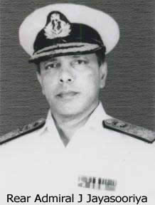
The first recorded survey by the Ceylon Navy was done in 1962/1963 when the Navy under took hydrographic surveys for the Pulmudai Mineral Sand Corporation using conventional means. The data collected was used for the nautical charting as well as for the construction of the pier and approaches to it. In 1967 Navy started to send officers for the Basic Hydrographiccourse in Indian National Hydrographic School, which was at Cochin at that time. The Naval Hydrographic Branch was established on 19 th January 1970, and the first officer to head it was then Lieutenant Justin Jayasooriya, who later rose to become the Chief of Staff.
 The Naval Hydrographic Branch was involved heavily in delineation of the maritime boundary between India & Sri Lanka in 1972 and some of those technical issues observed by the Indian Hydrographers (Head by then Commander Frazer of theNavy) were later used in making the 1982 UNCLOS & subsequent TALOS.
 On 13 th March 1984, as a national effort, the National Hydrographic Office (NHO) was established under the National Aquatic Resources Agencies (NARA) with the Navy's hydrographic equipments, and the Navy as a partner to head the Operational branch.
Today, the Navy had re-activated the hydrographic capabilities in an integrated approach, which will be beneficial to the nation. The Navy intends to extend its expertise to institutions like universities, Telecom & Petroleum Corporation thus pooling the resources for better productivity
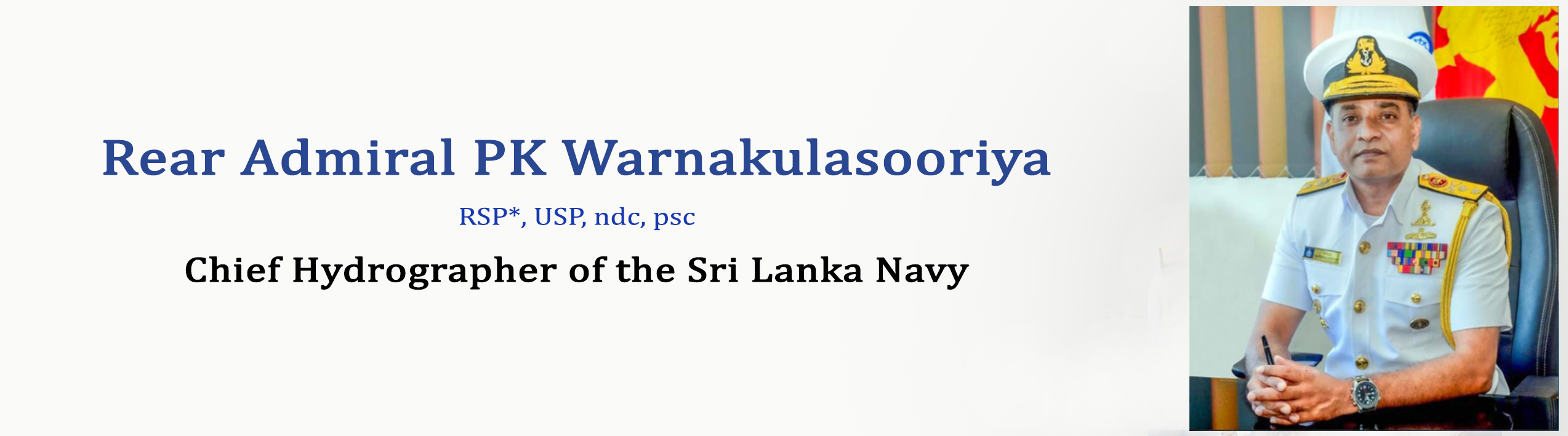

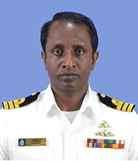
Rear Admiral Prasanna Kosala Warnakulasooriya assumed duties as the Chief Hydrographer of the Sri Lanka Navy on 10 th August 2023. He is from the Executive Branch of the Sri Lanka Navy and possesses a career more than 30 years in the active service.
Rear Admiral Warnakulasooriya was the first Sri Lankan Defence Adviser to the Sri Lanka High Commission in Canberra, Australia from 2019 to 2021. Further, he has held a number of Command, Operational and Administrative appointments at Naval Headquarters and various other Commands including, Senior Staff Officer (Operations) at Naval Headquarters, Acting Deputy Area Commander to the Northern Naval Command, Captain Operation Department & Acting Port Facility Security Officer to the Northern Naval Command and Director Hydrographic Operations at Naval Hydrographic Service. Currently he is serving as the Naval Assistant to the Commander of the Sri Lanka Navy.
He has commanded various classes of ships and craft in the Sri Lanka Navy including Sri Lanka Naval Ship (SLNS) ‘Sayura’, an offshore Patrol Vessel, Fast Passenger Vessel ‘Lanka Rani’, SLNS Weeraya and various classes of Fast Attack Craft and out of which, many long years in the Sri Lanka Navy’s elite ‘4th Fast Attack Craft Squadron’ during the conflict period in Sri Lanka.
For his bravery action displayed therein, he has been awarded the Gallantry Medal, ‘Rana Soora Padakkama’ (RSP) twice. In addition, he has been awarded with ‘Uththama Seva Padakkama’ (USP) for his excellent service rendered to the armed forces of Sri Lanka along with many other service medals and five-star commendation badge awarded by the Chief of the Navy. Rear Admiral Warnakulasooriya has served in the personal staffs of three consecutive Commanders of the Sri Lanka Navy from 2011 to 2014 as the Sri Lanka Navy Spokesman and Media Co-ordinator to the Commander of the Navy and Naval Co-ordinator for Media Centre of the Ministry of Defence, Sri Lanka.
He is a graduate of the General Sir John Kotelawala Defence University (KDU), Sri Lanka and has admitted to the Degree of Bachelor of Science (Defence Studies) in Mechanical Engineering in 1996. His academic career in the Navy includes many in-house and overseas training which includes the Graduation from the Defence Services Command & Staff Collage, Sri Lanka in year 2007 and securing of his first Masters from the University of Goa, India in ‘Hydrographic Surveying’ in year 2008. He completed the National Defence Course in Bangladesh in 2022 and secured a Masters in ‘Social Science in Security and Development’ from the University of Professionals in Dhaka, Bangladesh in year 2022.
Rear Admiral Kosala Warnakulasooriya is married to Rajika and blessed with two daughters, Ruwanya and Adithya.
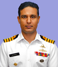
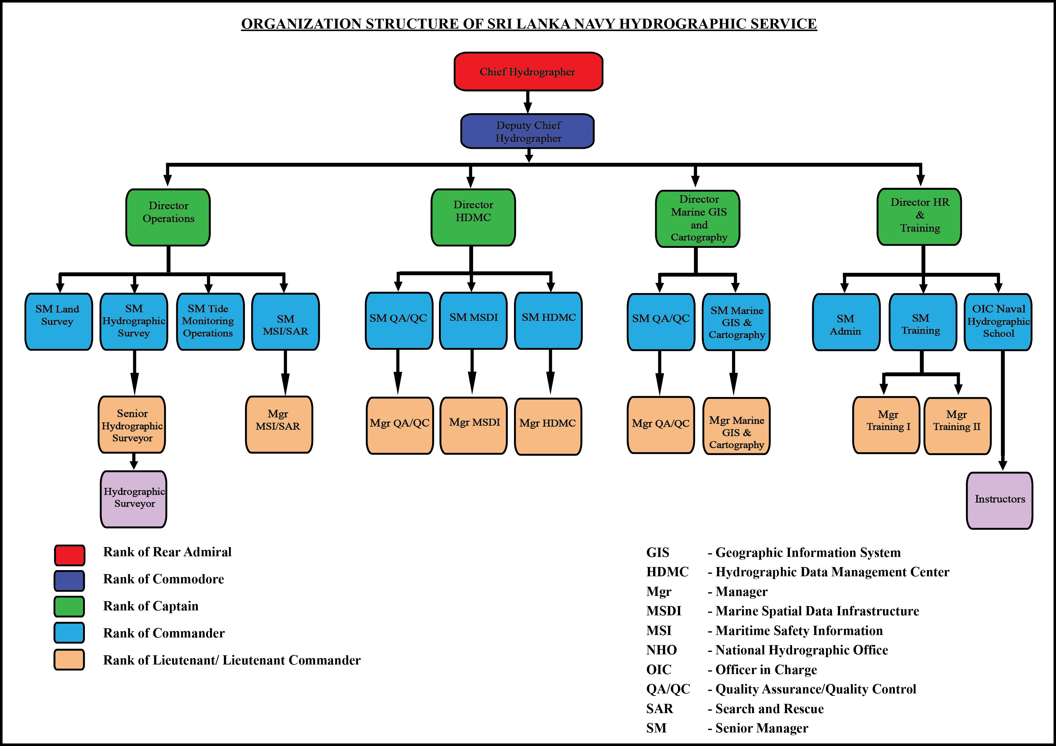
Director Hydrographic Operations
Capt(H) HBH Deeshana
Director HDMC
Cdr(H) SMSM Karunarathne
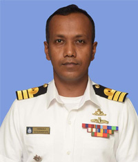
Director Marine GIS & Cartography
Cdr(H) UN Hewahakmanage
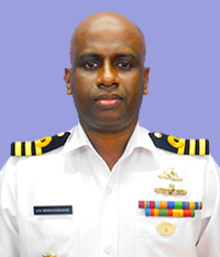
Director HR & Training
Cdr(H) HMNM Herath
Chief Hydrographer of the Sri Lanka Navy
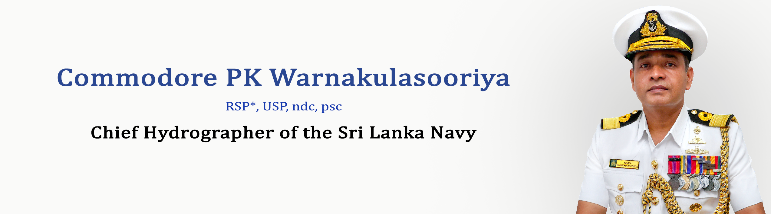
Rear Admiral Prasanna Kosala Warnakulasooriya is from the Executive Branch of the Sri Lanka Navy and possesses a career more than 30 years in the active service.
Commodore Warnakulasooriya was the first Sri Lankan Defence Adviser to the Sri Lanka High Commission in Canberra, Australia from 2019 to 2021. Further, he has held a number of Command, Operational and Administrative appointments at Naval Headquarters and various other Commands including, Senior Staff Officer (Operations) at Naval Headquarters, Acting Deputy Area Commander to the Northern Naval Command, Captain Operation Department & Acting Port Facility Security Officer to the Northern Naval Command and Director Hydrographic Operations at Naval Hydrographic Service. Currently he is serving as the Naval Assistant to the Commander of the Sri Lanka Navy.
He has commanded various classes of ships and craft in the Sri Lanka Navy including Sri Lanka Naval Ship (SLNS) ‘Sayura’, an offshore Patrol Vessel, Fast Passenger Vessel ‘Lanka Rani’, SLNS Weeraya and various classes of Fast Attack Craft and out of which, many long years in the Sri Lanka Navy’s elite ‘4 th Fast Attack Craft Squadron’ during the conflict period in Sri Lanka.
For his bravery action displayed therein, he has been awarded the Gallantry Medal, ‘Rana Soora Padakkama’ (RSP) twice. In addition, he has been awarded with ‘Uththama Seva Padakkama’ (USP) for his excellent service rendered to the armed forces of Sri Lanka along with many other service medals and five-star commendation badge awarded by the Chief of the Navy. Commodore Warnakulasooriya has served in the personal staffs of three consecutive Commanders of the Sri Lanka Navy from 2011 to 2014 as the Sri Lanka Navy Spokesman and Media Co-ordinator to the Commander of the Navy and Naval Co-ordinator for Media Centre of the Ministry of Defence, Sri Lanka.
He is a graduate of the General Sir John Kotelawala Defence University (KDU), Sri Lanka and has admitted to the Degree of Bachelor of Science (Defence Studies) in Mechanical Engineering in 1996. His academic career in the Navy includes many in-house and overseas training which includes the Graduation from the Defence Services Command & Staff Collage, Sri Lanka in year 2007 and securing of his first Masters from the University of Goa, India in ‘Hydrographic Surveying’ in year 2008. He completed the National Defence Course in Bangladesh in 2022 and secured a Masters in ‘Social Science in Security and Development’ from the University of Professionals in Dhaka, Bangladesh in year 2022.
Commodore Kosala Warnakulasooriya is married to Rajika and blessed with two daughters, Ruwanya and Adithya.