• Home
  • About Us
    • History
    • What We Do
    • Organization
    • Directorates
  • Products & Services
    • National Charts
    • ENC
    • Navigational Charts
    • Other Charts
    • Services
  • Strategic Directive
  • Gallery
  • Contact us
  • MSDI
  • Home
  • About us
  • Directorates

Directorates

Director Hydrographic Operations

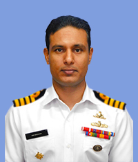
DIRECTOR HYDROGRAPHIC OPERATIONS

Capt(H) HBH Deeshana

RWP, RSP*, USP
Director Marine GIS & Cartography

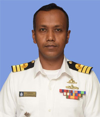
DIRECTOR MARINE GIS & CARTOGRAPHY

Cdr(H) UN Hewahakmanage

psc

Director HDMC

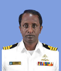
DIRECTOR HDMC

Cdr(H) SMSM Karunarathne

RSP, psc

Director HR & Training

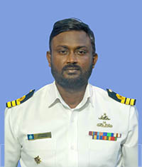
DIRECTOR HR & TRAINING

Cdr(H) HMNM Herath

USP, psc

Directorate of Hydrographic Operations

The main responsibility of this directorate is to proper conduct of all types of Hydrographic surveys including defence surveys and project surveys in lakes, rivers, coastal waters and offshore waters within Sri Lanka's jurisdiction and in accordance with the guidelines given in Hydrographic Instructions (HI) issued by the Chief Hydrographer. A Captain/ Commander ranked officer who is specialised in Hydrography and who is a qualified CAT 'A' Hydrographic surveyor (IHO/ FIG/ ICA - Category A) is eligible to head this directorate.

Directorate of Human Resources

All administrative and training matters pertaining to the function of SLNHS will be undertaken by the directorate of HR. A Captain/Commander ranked officer who is specialized in Hydrography and who is a qualified CAT 'A' Hydrographic surveyor (IHO/ FIG/ ICA – Category A) is eligible to head this directorate.

Directorate of Hydrographic Data Management

Hydrographic Data Management Centre (HDMC) is established for the functions of this directorate. Accordingly, this directorate is mainly responsible maintaining Data bank of all the previous data collections and for the Quality Assurance and Quality Control (QA/ QC) of all Hydrographic survey data which is sent to the HDMC on completion of each Hydrographic survey together with a comprehensive technical report called report of survey (ROS). A Captain/ Commander ranked officer who is specialized in Hydrography and who is a qualified CAT 'A' Hydrographic surveyor (IHO/ FIG/ ICA - Category A) is eligible to head this directorate.

Directorate of Marine GIS and Cartography

Production of final output arising from Hydrographic surveys, which are paper nautical charts, Raster Nautical Charts (RNCs), Electronic Navigation Charts (ENCs), Additional Military Layers (AMLs) and other thematic maps used by mariners and other customers are the major responsibilities of this directorate. A Captain/ Commander ranked officer who is specialized in Hydrography and who is a qualified CAT 'A' Hydrographic surveyor (IHO/ FIG/ ICA - Category A) together with IHO/ FIG/ ICA – Category B or Category A Cartography qualified officer is eligible to head this directorate.

Location Map
Related Links
  • www.navy.lk
  • www.defence.lk
  • www.nara.ac.lk
  • www.fisheries.gov.lk
  • www.meteo.gov.lk
  • www.survey.gov.lk
  • www.disastermin.gov.lk
  • www.slpa.lk
Contact Us
  • Sri Lanka Navy Hydrographic Service
  • Crow Island, Mattakkuliya, Colombo 15
  • Sri Lanka
  • Telephone : +94 11 7195049
  • Email : sectoch@gmail.com

Copyright © Sri Lanka Navy 2022 | Designed and maintained by Directorate of Naval Information Technology